HIGHLIGHTS
- Makalu is one of the harder and technical eight-thousanders, and is considered one of the most difficult mountains in the world to climb.
- Makalu Barun National Park, which is a natural wonder in its own.
- Mt. Makalu is 8481 meters and it is the 5th highest mountain in the worldand specific and it's a very technical peak.
At a glance
Overview
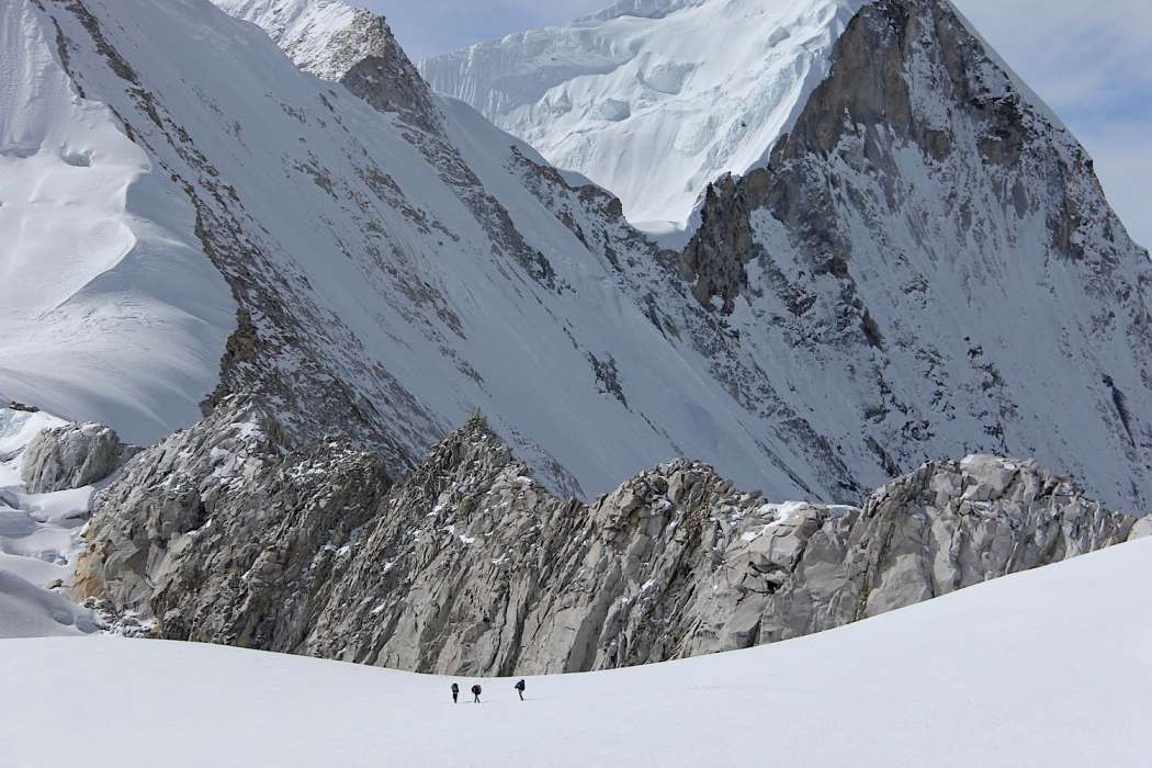
Makalu is the fifth tallest mountain on earth. A close neighbor to Mount Everest, it lies in the northeast region of Nepal. Makalu means the Great Black One, so-called due to its dark brooding appearance. Still, it is a relatively less attempted mountain. So far, the number of individual climbers who have attempted Makalu is only some 300+. Therefore, if you wish to attempt Makalu, you need to have a lot of mountaineering experience including one attempt on an 8,000 meter. The first attempt on Makalu was made by an American team in 1954, but it was first climbed by a French Team in 1955. The mountain has two important subsidiary peaks.
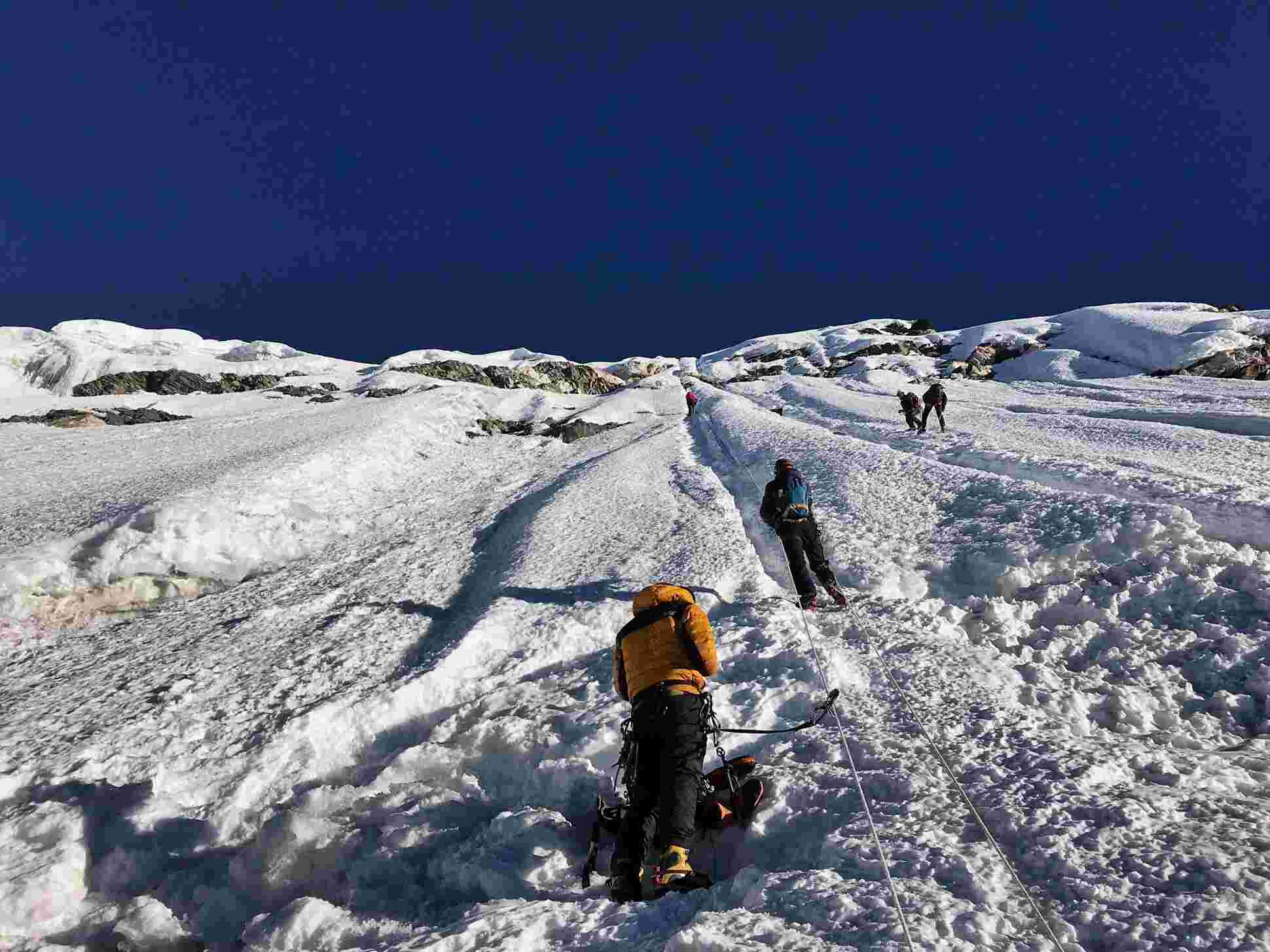
Makalu has steep pitches and knife-edged ridges. The final ascent of the summit pyramid involves technical ice and rock climbing. The route to Makalu Base Camp (4823m) involves a sustained steep slope with magnificent views of Makalu (8481m) to the north. Climbing Makalu is really a demanding attempt – it’s also the reason why Makalu has not been attempted like other peaks. From a base camp at the foot of the Chago Glacier, we will use 4 camps on the mountain, including camp 3 on the Makalu La at 7,400m and a high camp on the North Face at approximately 7,800m.
The route is composed of four main parts. The first part of the route starts at the base of the West Face (5800m) and climbs to the hanging ice-fall (6100m) to the right of the ice-fall. The second part extends at a 45 degree angle from the plateau above the ice-fall (4500m). Following this is an ice-rock wall that is at a 55 degree angle and extends to a height of 7400m. The final section begins with 70 to 75 degree rock pillar, which leads to the west ridge at 8,000 meters height through to the top of the summit.
Ropes are typically fixed from 5800m to 6100m and from 6500 m to 7500m. There are high camps established by the Russian Team at these locations.
The French Route on the West Pillar is an aesthetically stunning line that has been seldom attempted. It is an exceedingly difficult steep pillar that was first successfully ascended in 1971. The crux of the line comes at approximately 7,600m in the area of the Seignior Wall.
Itinerary
Day 01: Arrival in Kathmandu
Day 02: Flight from Kathmandu to Tumlingtar, Trek To Khadbari [1,040 m – four hrs walk.]
Day 03: Trek from Khadbari to Chichila [1830 m 5/6 hrs walk]
Day 04: Trek from Chichila to Num [1490 m - 5 hrs walk]
Day 05: Trek from Mum to Sedua [1460 m - 5/6 hrs walk]
Day 06: Trek from Seuda to Tashi Gaon [2070 M - 5 hrs walk]
Day 07: Tashi Gaon to Kauma [ 3470 m - 6 hrs walk]
Day 08: Rest Day At Kauma
Day 09: Trek from Kauma to Mumbuk [3570 m - 5 hrs walk]
Day 10: Trek from Mumbuk to Neh Kharkha [3700 m - 6 hrs walk]
Day 11: Trek from Neh Kharka to Sherson [4615 m 7 hrs walk]
Day 12: Trek from Sherson to Makalu Base Camp [5000 m - 4/5 hrs walk]
Day 13: Acclimatization Day At Makalu Base Camp
Day 14 - Day 43: Climbing Period for Makalu (8463m)
Day 44: Makalu Base Camp to Neh Kharka (3700 m)
Day 45: Trek from Neh Kharka to Mumbuk
Day 46: Mumbik to Kauma.
Day 47: Kauma to Tashi Gaon Today we stroll a bit lengthy to TashiGaon. Camp
Day 48: Trek to Pakuwa [1520 m]
Day 49: Trek from Pakuwa to Bumlung [[1160m]
Day 50: Trek from Bumling to Tumlingtar [860m]
Day 36: Flight from Tumlingtar to Kathmandu
Gallery

Book this tour
| Dates | Price | Single Sup | Status | Book/Enquire |
|---|---|---|---|---|
| - | On Request | Available | Any Date | Book Now |